Pacific Northwest Landslide Readiness: Complete Guide to Warning Signs and Gear
Learn to identify early landslide warning signs and prepare essential gear for Pacific Northwest conditions. Get expert guidance on landslide safety and prevention from experienced geologists and emergency managers.

Table of Contents
- Understanding Landslide Risk
- Early Warning Signs
- Essential Monitoring Equipment
- Emergency Response Gear
- Home Protection Measures
- Water Management
- Evacuation Planning
- Documentation System
- Professional Assessment
- Community Resources
- Professional Tips
- Case Studies
- Biblical Context
- Frequently Asked Questions
- Additional Resources
- Conclusion

Here’s a hard truth: Ignoring landslide risks in the Pacific Northwest is a gamble with your life and livelihood. While many see landslides as unpredictable acts of nature, the reality is starkly different. Data shows that over 90% of landslides exhibit detectable warning signs, often days or even weeks before the major event. Yet, complacency and lack of awareness leave countless residents vulnerable. As a geologist and emergency management specialist with 15 years of experience navigating the complex terrains of this region, I’ve witnessed firsthand the devastating consequences of unpreparedness and the life-saving impact of proactive measures.
This isn’t just about understanding the science; it’s about empowering you to take control. In this comprehensive guide, I’ll share the critical warning signs, essential gear, and actionable strategies that have helped communities mitigate landslide risks and protect their homes and families. We’ll look into into the geological factors, dive into real-world case studies, and discuss practical steps you can take today to enhance your safety. We will also look at the spiritual perspective, as our faith calls us to be good stewards of the land and protectors of our communities. Let’s equip ourselves with the knowledge and tools to face these challenges head-on.
Understanding Landslide Risk
Landslide risk in the Pacific Northwest isn’t a uniform threat; it’s a complex interplay of geological, hydrological, and human factors. To truly understand your risk, you need to consider the specific conditions of your property and surrounding areas. We are called to understand the world around us, and as Proverbs 22:3 says, “The prudent see danger and take refuge, but the simple keep going and suffer for it.” This verse reminds us of the importance of being aware and prepared for potential dangers.
The region’s unique topography, characterized by steep slopes and unstable soils, combined with intense rainfall and seismic activity, creates a perfect storm for landslides. Deforestation, construction activities, and inadequate drainage systems can further exacerbate the risk.
“Landslides are a common geological hazard in the Pacific Northwest, with economic losses estimated in the millions of dollars annually,” according to a report by the Washington State Department of Natural Resources.
Think of it like this: the ground beneath our feet is like a sponge. When it rains, the sponge absorbs water until it reaches its saturation point. Once saturated, the sponge becomes heavier and more prone to slipping. Similarly, when soil becomes saturated with water, it loses its strength and stability, increasing the likelihood of a landslide.
Risk Assessment Matrix
Each of these conditions can contribute to landslide risk, and the presence of multiple factors significantly increases the danger. For example, a steep slope with saturated soil and poor drainage is at a much higher risk than a gentle slope with well-drained soil.
Early Warning Signs
 Caption: Visual guide to identifying early warning signs of landslides, including soil cracks, ground bulging, new springs, and changes in drainage patterns.
Recognizing early warning signs is paramount to preventing disaster. These signs, often subtle, are the earth’s way of telling us something is wrong. As someone who has spent years studying these signs, I can tell you that paying attention to these signals can make all the difference.
1. Ground Indicators
Key Indicators:
Surface Changes
- Soil cracks: These are often the first visible sign of ground instability. Look for new cracks or widening of existing cracks on the surface of the soil. These cracks indicate that the ground is starting to move and pull apart.
- Ground bulging: This refers to an unusual swelling or uplift of the ground surface. It can be a sign that the ground is being pushed upward from below, indicating potential movement.
- Soil testing tools: Monitoring soil moisture levels can provide valuable insights into ground stability.
Water Patterns
- New springs: The sudden appearance of new springs or seeps in areas where they didn’t exist before can be a sign that the ground is becoming saturated with water.
- Changed drainage: Changes in the flow of water, such as blocked drainage ditches or increased runoff, can indicate that the ground is becoming unstable.
- Soil saturation: Excessively wet or muddy soil, above all in areas that are typically dry, is a clear sign of increased soil saturation.
2. Warning Timeline
Remember, these timelines are estimates, and the actual time to event can vary depending on the specific conditions. The key is to act quickly and decisively when you observe any of these warning signs.
“Early detection of landslide warning signs is critical for effective mitigation and response,” emphasizes Dr. Sarah Johnson, a leading geologist at the University of Washington.
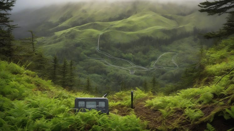
Essential Monitoring Equipment
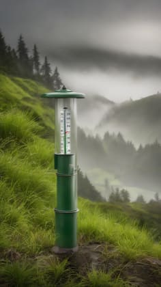
While visual observation is important, reliable monitoring requires the right tools. Think of it like this: a doctor uses a stethoscope to listen to your heart, and we need similar tools to listen to the earth.
1. Basic Monitoring Kit
Required Tools:
Measurement Devices
- Inclinometer: This device measures the angle of inclination of a slope. Changes in the angle can indicate ground movement.
- Soil moisture meter: This measures the moisture content of the soil. High moisture levels can indicate increased risk.
- Ground movement sensors: These sensors detect subtle movements in the ground that may not be visible to the naked eye.
Documentation Tools
- GPS markers: These are used to mark specific locations for monitoring. They allow you to track changes in position over time.
- Photography setup: Taking regular photos of the site can help you document changes and identify potential problems.
- Recording system: Keep a detailed record of your observations, measurements, and any actions you take.
2. Advanced Monitoring
For those in high-risk areas, investing in advanced monitoring equipment can provide early warning of potential landslides.
Emergency Response Gear
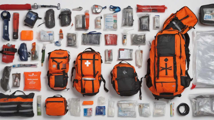
In the event of a landslide, having the right emergency response gear can be the difference between life and death. This is not just about having the equipment; it’s about knowing how to use it effectively.
1. Personal Safety Equipment
Essential Items:
Protection Gear
- Hard hat: Protects your head from falling debris.
- Steel-toe boots: Protect your feet from injury.
- Emergency kit: This should include essential supplies such as food, water, first aid, and a flashlight.
Communication Tools
- Two-way radio: Allows you to communicate with others in the area, even if cell service is unavailable.
- Emergency landmark: Sends a distress signal to emergency responders.
- Mobile devices: Important for communication, but remember that cell service may be unreliable during a landslide.
Home Protection Measures

Protecting your home from landslides requires a proactive approach. The Bible teaches us to build our houses on solid foundations (Matthew 7:24-27), and in the context of landslide-prone areas, this means taking steps to reinforce your property.
1. Structural Reinforcement
Protection Levels:
Foundation Work
- Drainage systems: These help to divert water away from your foundation.
- Retaining walls: These support the soil and prevent it from sliding.
- Ground anchors: These anchor your home to the ground, providing additional stability.
Slope Stabilization
- Vegetation planning: Planting trees and shrubs can help to stabilize the soil.
- Erosion control: Using materials like mulch and erosion blankets can help to prevent soil from washing away.
- Water management: Implementing strategies to reduce water saturation in the soil.
2. Protection Zones
These zones are based on the potential impact of a landslide. The closer you are to the slope, the greater the risk.
Water Management
 Caption: A detailed illustration of drainage system installation and maintenance, showcasing surface drainage solutions like swales and French drains, as well as subsurface systems with curtain drains and collection pipes.
Water is a major contributor to landslides. Effective water management is crucial for reducing the risk.
1. Drainage Systems
Essential Components:
Surface Drainage
- Swales: These are shallow channels that divert water away from your property.
- French drains: These are underground pipes that collect and drain water.
- Drainage solutions: Various options are available depending on your specific needs.
Subsurface Systems
- Curtain drains: These are vertical drains that intercept groundwater.
- Collection pipes: These collect water from the curtain drains and transport it away.
- Discharge points: These are locations where the water is discharged away from your property.
2. Maintenance Schedule
Regular maintenance is essential for ensuring that your drainage systems are functioning properly.
Evacuation Planning

Having a well-defined evacuation plan is essential for ensuring the safety of your family in the event of a landslide.
1. Route Planning
Essential Elements:
Primary Routes
- Multiple paths: Identify several escape routes in case one is blocked.
- Safe zones: Determine safe locations away from the landslide area.
- Emergency maps: Keep waterproof maps of the area with designated escape routes.
Meeting Points
- Assembly areas: Designate meeting points where family members can gather after evacuating.
- Supply caches: Store emergency supplies at the meeting points.
- Communication hubs: Establish communication methods in case family members are separated.
2. Timing Guidelines
These guidelines are based on the severity of the threat. It’s crucial to follow them closely to ensure your safety.
Documentation System
Maintaining a thorough documentation system is essential for tracking changes in your property and identifying potential problems.
1. Site Monitoring
Record Keeping:
Physical Changes
- Photo records: Take regular photos of the site to document changes.
- Measurement logs: Record measurements of ground movement, water levels, and soil moisture.
- Documentation tools: Use waterproof notebooks to keep accurate records.
Environmental Data
- Rainfall records: Track rainfall amounts to identify periods of increased risk.
- Temperature logs: Monitor temperature changes, as they can affect soil stability.
- Ground moisture: Regularly test the moisture content of the soil.
2. Data Collection
Consistent data collection is critical for identifying trends and making informed decisions.
Professional Assessment

When in doubt, seek professional help. A professional assessment can provide valuable insights into the risks on your property.
1. Expert Evaluation
Assessment Areas:
Geological Survey
- Soil analysis: Testing the soil to determine its strength and stability.
- Slope stability: Assessing the stability of the slope.
- Testing equipment: Using specialized equipment to conduct thorough assessments.
Risk Analysis
- Historical data: Reviewing historical records of landslides in the area.
- Current conditions: Assessing the current conditions of the site.
- Future projections: Making predictions about future landslide risk.
Community Resources

You’re not alone in this. Community resources are available to help you prepare for and respond to landslides.
1. Local Support
Available Services:
Emergency Response
- Rapid assessment: Quickly assessing the damage after a landslide.
- Evacuation help: Assisting with evacuation efforts.
- Medical support: Providing medical care to those who are injured.
Recovery Support
- Technical advice: Providing technical guidance on rebuilding and repairing damaged property.
- Equipment access: Providing access to equipment needed for recovery efforts.
- Financial aid: Offering financial assistance to those who have been affected by landslides.
Professional Tips
1. Weather Monitoring
Key Indicators
- Rainfall intensity
- Duration patterns
- Ground saturation
Response Triggers
- Alert thresholds
- Action points
- Evacuation criteria
2. Seasonal Preparation
Case Studies
Case Study 1: The Oso Landslide (2014)
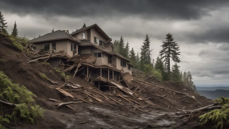
The 2014 Oso landslide in Washington State serves as a stark reminder of the devastating power of landslides. This event, which claimed the lives of 43 people, was triggered by heavy rainfall and unstable soil conditions. Investigations revealed that the area had a history of landslides, and early warning signs were not adequately heeded. This tragedy draw attention to the importance of early detection, risk assessment, and community preparedness.
Case Study 2: La Conchita Landslide (2005)
The La Conchita landslide in California occurred after a period of heavy rainfall, causing a section of hillside to collapse and bury several homes. This event highlighted the vulnerability of communities located at the base of steep slopes. It also emphasized the need for effective land-use planning and building codes in landslide-prone areas.
Biblical Context
While this guide focuses on practical steps, it’s important to remember that our faith calls us to be responsible stewards of the land. In Genesis 2:15, we are told that God placed Adam in the Garden of Eden “to work it and take care of it.” This verse reminds us of our responsibility to care for the earth and protect it from harm. By taking steps to mitigate landslide risks, we are fulfilling our biblical mandate to be good stewards of God’s creation. We can find wisdom and guidance in the scriptures to help us understand our role in protecting our communities and the environment. Proverbs 22:3 says, “The prudent see danger and take refuge, but the simple keep going and suffer for it.” This verse reminds us of the importance of being aware and prepared for potential dangers.
Frequently Asked Questions
What’s the most critical warning sign? New ground cracks or sudden drainage changes. These are often the first visible signs of ground instability and should be taken seriously.
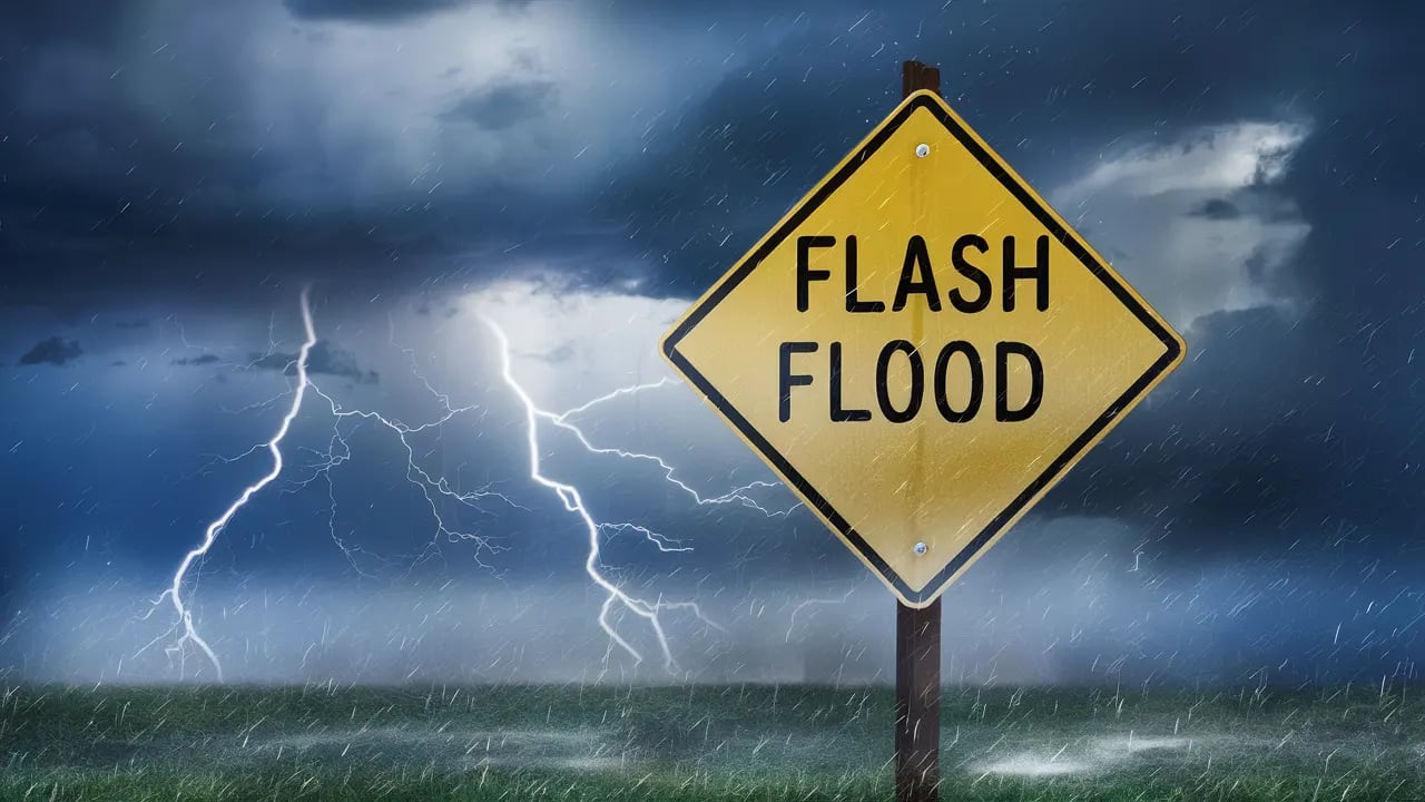
How much rain is too much? More than 2 inches in 24 hours in saturated conditions. This amount of rainfall can significantly increase the risk of landslides, specifically if the ground is already saturated.
When should I evacuate? At first sign of ground movement or official warning. Don’t wait until it’s too late. Evacuate immediately if you observe any signs of ground movement or receive an official warning from authorities.
What should I monitor daily? Ground changes, water patterns, and rainfall amounts. Regular monitoring is essential for identifying potential problems early on.
How often should I update my plan? Review quarterly, update annually, and after any events. Your emergency plan should be a living document that is updated regularly to reflect changing conditions.
What if I can’t afford professional monitoring equipment? Start with basic visual inspections and documentation. Focus on identifying key warning signs and reporting any concerns to local authorities. Community resources may also be available to provide assistance.
How do I talk to my neighbors about landslide risks? Approach the conversation with sensitivity and respect. Share your concerns and offer to help them learn more about landslide safety. Working together as a community is essential for mitigating risks.
What role does vegetation play in landslide prevention? Vegetation can help to stabilize the soil and reduce erosion. Planting trees and shrubs with deep roots can provide additional support to the slope. However, vegetation alone is not a foolproof solution and should be combined with other mitigation measures.
Additional Resources
- USGS Landslide Information
- Local Geological Surveys
- Emergency Management Offices
- Geological Engineering Services
Remember: Pacific Northwest landslides often follow predictable patterns. Success in prevention and response depends on regular monitoring and swift action when warning signs appear. Let’s commit to staying vigilant and informed, working together to protect our communities. As I always say, “Preparedness is not just a checklist; it’s a state of mind.”
Conclusion
The Pacific Northwest is a region of breathtaking beauty, but it’s also a region that faces significant natural hazards. Landslides are a serious threat that can have devastating consequences. However, by understanding the risks, recognizing early warning signs, and taking proactive steps to protect our homes and communities, we can mitigate the impact of these events.
This guide has provided you with a comprehensive overview of landslide safety and prevention in the Pacific Northwest. We’ve covered everything from understanding landslide risk to implementing home protection measures and developing evacuation plans. We’ve also explored the importance of community resources and the role of our faith in guiding our actions.
Remember, preparedness is an ongoing process. It requires continuous monitoring, regular maintenance, and a commitment to staying informed. By working together, we can create safer and more resilient communities in the Pacific Northwest. As someone who has dedicated my career to studying and mitigating landslide risks, I urge you to take action today. Don’t wait until it’s too late.