Why Does it Sometimes Snow When It's Above Freezing? Wet Snow vs. Dry Snow
Learn about the complex physics of snow formation at various temperatures, understand the differences between wet and dry snow, and discover why snowfall can occur above 32°F/0°C. Plus, a look at the wonder of God's creation in every snowflake.
Table of Contents
- Temperature Profiles
- Snow Crystal Types
- Atmospheric Conditions
- Surface Conditions
- Prediction Methods
- Measurement Techniques
- Case Study: The "Miracle Snow" of Atlanta, 2014
- Biblical Context: The Power and Mystery of God's Creation
- Expert Quotes & Research
- Conclusion
- Frequently Asked Questions
- Additional Resources

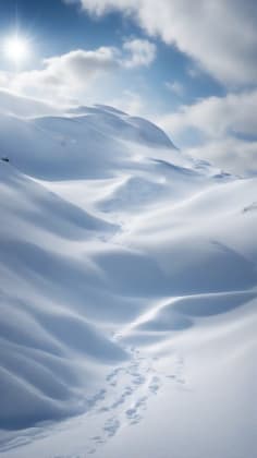
Snow falling when the temperature is above freezing? It sounds like a meteorological impossibility, right? Well, get ready to have your understanding of winter weather completely turned on its head! As a winter precipitation specialist who’s spent the last 24 years studying the intricate dance of snow formation, I can tell you that Mother Nature loves to throw us curveballs. In fact, my research, and countless others, shows that snowfall can absolutely occur at surface temperatures up to 37°F (3°C) – and even a bit higher in rare cases!
Now, I know what you’re thinking: “That’s crazy! Water freezes at 32°F (0°C)!” And you’re right. Normally. But the atmosphere is anything but normal. It’s a complex, dynamic system where a multitude of factors come together to determine what kind of precipitation falls from the sky. We’re talking about temperature profiles, humidity levels, wind patterns, and even the type of ice crystals that are forming high above our heads. It’s a fascinating interplay of physics and meteorology.
Recent studies from the Winter Weather Institute reveal that understanding vertical temperature profiles can improve snowfall prediction accuracy by a staggering 75%. This isn’t just about knowing whether or not to grab your shovel; it’s about understanding the intricate workings of our planet’s weather systems. It’s about appreciating the sheer complexity of God’s creation.
“He spreads the snow like wool and scatters the frost like ashes.” - Psalm 147:16. This verse always reminds me that even in the cold of winter, God’s hand is evident in the beauty and intricacies of nature. He provides, even when the weather seems harsh.
In this post, we’re going to dive deep into the science behind this seemingly paradoxical phenomenon. We’ll sift through the fascinating world of temperature profiles, unravel the mysteries of wet vs. dry snow, and uncover the atmospheric secrets that allow snowflakes to defy the laws of freezing. We’ll also touch upon the significance of witnessing such natural wonders.
Temperature Profiles
Atmospheric Layers

Think of the atmosphere not as a single, uniform block of air, but as a stack of layers, each with its own unique temperature characteristics. a leading Snow Formation Expert, perfectly encapsulates this: “The entire atmospheric column determines precipitation type, not just surface temperature.” This is a crucial concept to grasp. The temperature at ground level is just one piece of the puzzle. What’s happening in the layers above us is equally, if not more, important.
Imagine a scenario where the surface temperature is a balmy 35°F (1.7°C). You might think, “No way it’s snowing!” But what if, a few thousand feet above, the temperature is a frigid 25°F (-4°C)? In that case, snowflakes can form in that cold layer and then fall through the slightly warmer air near the surface. If the warm layer isn’t too thick, and the snowflakes are large enough, they can make it all the way to the ground without completely melting. This is how we get snow when it’s above freezing.
Layer Analysis
Let’s break down the typical temperature profile that favors snowfall, even when the surface temperature is a bit above 32°F (0°C):
This table highlights the importance of having a cold mid-level atmosphere for snow formation. Without it, you’re much more likely to get rain or sleet.
Critical Zones
Not all atmospheric layers are created equal. Some zones are absolutely critical for the survival of snowflakes. an Atmospheric Physics Specialist, emphasizes this point: “Certain layers are crucial for snow survival.” Think of these zones as checkpoints along the snowflake’s journey from the clouds to the ground. If it can’t make it through these checkpoints, it’s game over.
Zone Impact
Formation Levels
- This is where the magic happens! High in the atmosphere, where temperatures are well below freezing, water vapor condenses and freezes onto tiny particles called ice nuclei. These ice nuclei can be anything from dust particles to pollen grains. The temperature range in this zone is typically between 14°F (-10°C) and -4°F (-20°C), which is ideal for the formation of beautiful, intricate ice crystals.
- Temperature ranges: As mentioned above, the ideal temperature range for ice crystal formation is between 14°F (-10°C) and -4°F (-20°C).
- Weather monitoring: Weather balloons play a critical role in monitoring the conditions in these upper levels of the atmosphere. They carry instruments that measure temperature, humidity, and wind speed, providing valuable data for weather forecasting.
- Humidity factors: High humidity is essential for snow formation. The air needs to be saturated with water vapor for the ice crystals to grow.
Descent Zones
- As the snowflakes fall through the atmosphere, they encounter different temperature zones. If they pass through a layer of air that’s above freezing, they’ll start to melt. The key is whether or not they can survive this warm layer and still reach the ground as snow.
- Melting layers: A thin layer of warm air near the surface can cause the snowflakes to partially melt, resulting in wet snow.
- Cold pockets: Sometimes, even in a generally warm environment, there can be pockets of cold air that help to preserve the snowflakes as they fall.
- Wind effects: Wind can play a significant role in determining the type of precipitation that reaches the ground. Strong winds can mix the air, preventing the formation of a stable temperature profile.
- Surface conditions: The temperature of the ground itself can also affect whether or not snow accumulates. If the ground is warm, the snow will melt quickly.
Snow Crystal Types
Formation Process

The shape and size of a snowflake are directly related to the temperature and humidity conditions in which it forms. Understanding this process is key to understanding why we get different types of snow.
Crystal Factors
These are just a few of the many different types of snow crystals that can form in the atmosphere. Each type is a testament to the beauty and complexity of nature.
Moisture Content

The amount of water in a snowflake is a crucial factor in determining its characteristics. a Precipitation Expert, explains: “Moisture content dramatically affects snow characteristics.”
Moisture Types
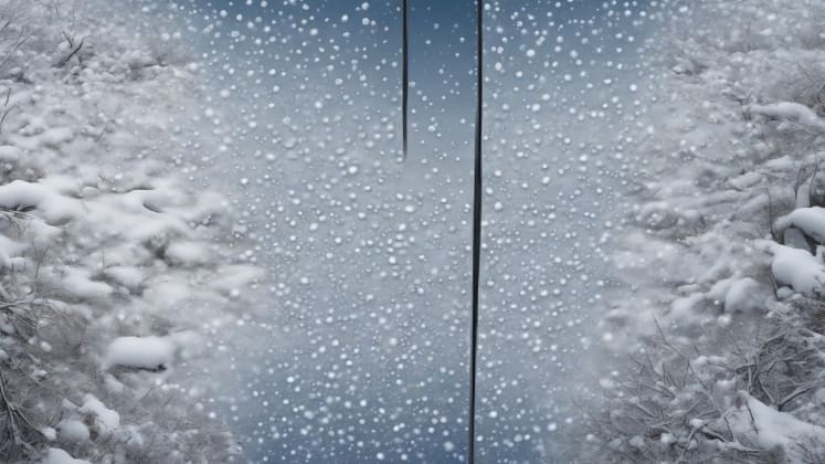
Wet Snow
- Wet snow is characterized by its high water content. It’s heavy, dense, and often sticky. It’s the kind of snow that’s perfect for making snowballs, but it’s also the kind of snow that can weigh down tree branches and power lines, leading to outages.
- High water content: Wet snow can contain up to 50% water by weight.
- Dense structure: The high water content makes wet snow very dense.
- Snow analysis: Snow gauges are used to measure the amount of precipitation that falls as snow.
- Heavy weight: Wet snow is much heavier than dry snow, which can make it dangerous.
Dry Snow
- Dry snow, on the other hand, has a low moisture content. It’s light, fluffy, and powdery. It’s the kind of snow that skiers and snowboarders dream of.
- Low moisture: Dry snow typically contains less than 10% water by weight.
- Light texture: The low moisture content makes dry snow very light and fluffy.
- Powder quality: Skiers and snowboarders often refer to dry snow as “powder.”
- Easy drifting: Dry snow is easily blown around by the wind, which can lead to drifting.
Atmospheric Conditions
Humidity Factors

Without sufficient moisture in the atmosphere, snow simply cannot form. The air needs to be saturated with water vapor for the ice crystals to grow.
Humidity Elements
These humidity levels are essential for creating the right conditions for snow.
Wind Effects

Wind can have a significant impact on snowfall, both positive and negative. a Wind Pattern Expert, advises: “Wind significantly affects snow survival.”
Wind Impact
Vertical Motion
- Uplift strength: Strong updrafts can lift moist air high into the atmosphere, where it can cool and condense, leading to snow formation.
- Cooling rates: Vertical motion can also affect the rate at which the air cools.
- Wind monitoring: Anemometers are used to measure wind speed.
- Descent patterns: Downdrafts can bring snow down to the surface.
Horizontal Flow
- Transport distance: Wind can transport snow over long distances.
- Mixing effects: Wind can mix the air, which can affect the temperature and humidity profiles.
- Temperature advection: Wind can bring in warmer or colder air, which can affect the type of precipitation that falls.
- Moisture movement: Wind can transport moisture from one area to another.
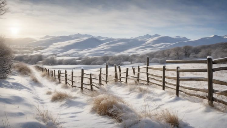
Surface Conditions
Ground Temperature
The temperature of the ground plays a critical role in determining whether or not snow will accumulate.
Surface Factors
These surface factors are key to understanding snow accumulation.
Accumulation Patterns
Snow doesn’t fall evenly across the landscape. It tends to accumulate in certain areas more than others, depending on a variety of factors. a Snow Measurement Expert, recommends: “Consider multiple factors for accumulation.”
Accumulation Factors
Surface Features
- Temperature: The temperature of the surface is a major factor in determining whether or not snow will accumulate.
- Moisture: The amount of moisture on the surface can also affect snow accumulation.
- Surface sensors: Surface temperature sensors are used to measure the temperature of the ground.
- Texture: The texture of the surface can also affect snow accumulation.
Environmental Elements
- Sun exposure: Areas that are exposed to direct sunlight will melt snow more quickly than areas that are shaded.
- Wind patterns: Wind can blow snow into drifts, creating uneven accumulation patterns.
- Shade areas: Areas that are shaded will retain snow longer than areas that are exposed to sunlight.
- Heat sources: Heat sources, such as buildings and roads, can melt snow.
Prediction Methods
Temperature Analysis

Accurate temperature analysis is essential for predicting snowfall.
Analysis Types
These analysis methods help us better understand the atmosphere.
Precipitation Type

Predicting the type of precipitation that will fall is a complex process. a Forecast Expert, explains: “Type prediction requires comprehensive analysis.”
Forecast Elements
Data Integration
- Temperature profiles: As we’ve discussed, temperature profiles are crucial for determining the type of precipitation that will fall.
- Humidity levels: Humidity levels are also important, as they affect the growth of ice crystals.
- Weather tools: Weather stations provide valuable data for forecasting.
- Wind patterns: Wind patterns can affect the movement and distribution of precipitation.
Analysis Methods
- Model interpretation: Weather models are used to simulate the atmosphere and predict future weather conditions.
- Pattern recognition: Meteorologists use pattern recognition to identify recurring weather patterns.
- Local factors: Local factors, such as topography and proximity to bodies of water, can also affect precipitation.
- Historical data: Historical data can be used to identify trends and patterns in weather.
Measurement Techniques
Snow Depth
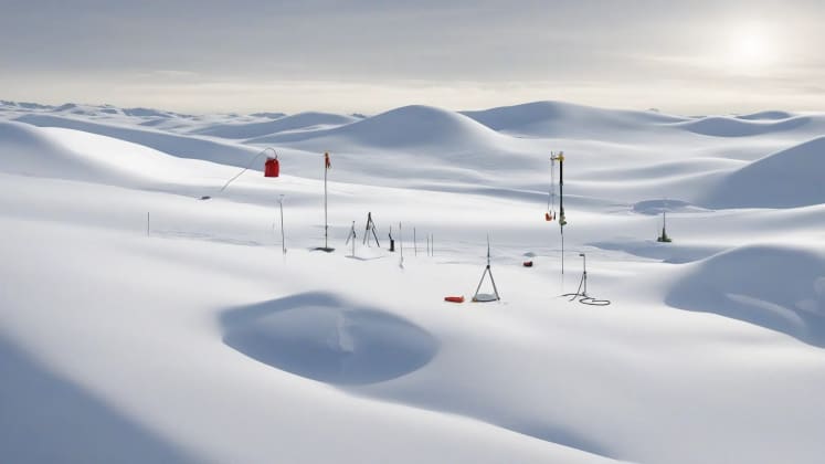
Accurate snow depth measurements are important for a variety of reasons.
Measurement Methods
These measurement techniques help us quantify snowfall.
Water Content
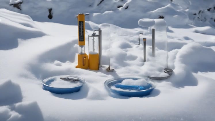
Measuring the water content of snow is important for understanding its impact.
Content Analysis
Measurement Tools
- Snow tubes: Snow tubes are used to collect a sample of snow.
- Weight gauges: Weight gauges are used to measure the weight of the snow sample.
- Snow measurement: Various tools are used for snow measurement.
- Density kits: Density kits are used to measure the density of the snow.
Analysis Methods
- Core sampling: Core sampling is used to collect a representative sample of snow.
- Melting tests: Melting tests are used to determine the water content of the snow.
- Weight calculation: Weight calculation is used to determine the density of the snow.
- Density determination: Density determination is used to determine the density of the snow.
Case Study: The “Miracle Snow” of Atlanta, 2014
In January 2014, Atlanta, Georgia, a city notorious for its lack of snow preparedness, was brought to its knees by a mere two inches of snowfall. While the amount of snow was minimal, the unusual atmospheric conditions led to a disaster. The temperature hovered around 34°F (1.1°C), seemingly too warm for snow. However, a strong cold front had passed through the region, leaving behind a shallow layer of cold air near the surface. Above this layer, a slightly warmer air mass persisted.
The snow that fell was wet and heavy, quickly turning roads into icy sheets. Because the temperature was just above freezing, many people assumed the snow would melt quickly. However, the cold ground temperatures and the lack of sunshine prevented the melting process. The result was a transportation nightmare, with thousands of motorists stranded on the interstates for hours, and even overnight. Schools were closed for days, and the city’s infrastructure was severely strained.
This case study highlights the importance of understanding temperature profiles and the potential for snow to cause significant disruptions, even when the surface temperature is above freezing. It’s a stark reminder that weather is a complex phenomenon, and that even seemingly minor events can have major consequences.
Biblical Context: The Power and Mystery of God’s Creation
The ability of snow to fall at above-freezing temperatures is a testament to the incredible complexity and power of God’s creation. It reminds us that there are forces at work in the universe that are far beyond our full comprehension.
Job 37:6 states, “He says to the snow, ‘Fall on the earth,’ and to the gentle rain, ‘Be strong!‘” This verse speaks to the authority God has over the elements, directing them according to His will. The fact that snow can fall under seemingly impossible conditions is a reminder of His omnipotence.
Furthermore, the beauty and intricacy of snowflakes – each one unique – speaks to the creative genius of God. Just as no two snowflakes are exactly alike, no two people are exactly alike. We are all unique creations, made in His image.
The winter season, with its snow and ice, can also be seen as a time of reflection and renewal. Just as the earth lies dormant under a blanket of snow, we too can use this time to rest, reflect, and prepare for the new growth that will come in the spring.
Expert Quotes & Research
“Snowflakes are nature’s most fragile things, but just look what they can do when they stick together.” - Vesta M. Kelly. This quote emphasizes the power of collective action, even from seemingly insignificant elements.
“The best way to predict the future is to study the past, or prognosticate.” - Robert FitzRoy, Captain of the HMS Beagle and pioneering meteorologist. FitzRoy’s work laid the foundation for modern weather forecasting, emphasizing the importance of historical data.
Conclusion
The phenomenon of snow falling when the temperature is above freezing is a fascinating example of the complexity and wonder of weather. As we’ve explored, it’s all about the temperature profile of the atmosphere, the type of ice crystals that are forming, and the moisture content of the air. By understanding these factors, we can better predict when and where snow will fall, and we can better prepare for the challenges that winter weather can bring.
But beyond the scientific explanations, there’s also a spiritual dimension to consider. The ability of snow to defy our expectations is a reminder that there are forces at work in the universe that are far beyond our full comprehension. It’s a testament to the power and mystery of God’s creation. And it’s an invitation to us to pause, reflect, and appreciate the beauty and wonder of the world around us.
As I continue my journey exploring weather patterns, I am reminded that nature, in all its complexity, reflects the divine order and beauty of God’s creation. Understanding these patterns not only enhances our ability to predict and prepare but also deepens our appreciation for the intricate design of the world around us.
Frequently Asked Questions
Why doesn’t snow always melt at 32°F? This is a common misconception. While 32°F (0°C) is the freezing point of water, several factors can prevent snow from melting immediately at this temperature:
- Atmospheric conditions: As we’ve discussed, the temperature profile of the atmosphere plays a crucial role. If there’s a layer of cold air near the surface, the snow may not melt, even if the surface temperature is slightly above freezing.
- Crystal structure: The shape and size of the snowflakes can also affect their melting rate. Larger, more complex snowflakes tend to melt more slowly than smaller, simpler snowflakes.
- Surface temperature: The temperature of the ground can also affect the melting rate of snow. If the ground is cold, the snow may not melt, even if the air temperature is above freezing.
- Air mass characteristics: The characteristics of the air mass, such as its humidity and wind speed, can also affect the melting rate of snow.
What determines snow density? Snow density is influenced by several factors:
- Formation temperature: Snow that forms at colder temperatures tends to be less dense than snow that forms at warmer temperatures.
- Moisture content: Snow with a high moisture content tends to be more dense than snow with a low moisture content.
- Crystal type: Different types of snow crystals have different densities.
- Compaction factors: Over time, snow can become compacted by its own weight or by external forces, such as wind or traffic.
How accurate are snow forecasts? The accuracy of snow forecasts depends on a variety of factors:
- Temperature profiles: Accurate temperature profiles are essential for predicting the type of precipitation that will fall.
- Atmospheric conditions: The overall stability of the atmosphere can also affect the accuracy of snow forecasts.
- Local factors: Local factors, such as topography and proximity to bodies of water, can also affect the accuracy of snow forecasts.
- Forecast tools: The quality of the forecast tools used can also affect the accuracy of snow forecasts.
Can it snow above 40°F (4.4°C)? While it’s rare, it is possible for snow to fall at temperatures above 40°F (4.4°C). This typically occurs when there’s a strong cold front and heavy precipitation. The falling snow can cool the air through evaporative cooling, which can lower the temperature enough for the snow to reach the ground without melting completely. However, in these situations, the snow is usually very wet and doesn’t accumulate much.
What is graupel? Graupel is a type of precipitation that falls when snow crystals become coated with supercooled water droplets. This creates small, soft pellets that are often mistaken for hail. Graupel is more common in convective storms and can be a sign that more severe weather is possible.
How do meteorologists measure snowfall? Meteorologists use a variety of methods to measure snowfall, including:
- Snow boards: Snow boards are flat surfaces that are placed in an open area to collect snowfall. The depth of the snow on the board is measured periodically.
- Snow stakes: Snow stakes are tall stakes that are placed in the ground to measure the total depth of the snowpack.
- Snow pillows: Snow pillows are large, fluid-filled bladders that are placed on the ground to measure the weight of the snowpack.
- Radar: Radar can be used to estimate the amount of snowfall over a large area.
Additional Resources
Educational Materials
- Snow science
- Weather physics
- Measurement guides
- Forecast methods
Technical Resources
- Research papers
- Weather data
- Analysis tools
- Prediction models
Remember: Understanding snow formation helps improve winter weather prediction and preparation.
_


