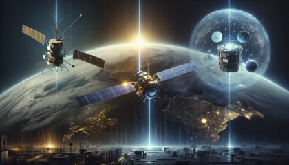
Weather Satellites: Past, Present, and Future
Journey through the evolution of weather satellites from their inception to their current applications and glimpse into future innovations. Understand their impact on our daily weather forecasts and emergency preparedness.
Let’s get one thing straight: weather forecasts would be nearly impossible without weather satellites. Yes, you heard me right. Ever tried planning a family picnic only to have it ruined by unexpected rain? Or had to evacuate because of a hurricane that was detected too late? Trust me, without the magnificent eyes in the sky, our weather predictions would be in the dark ages.
Today, we’ll inspect the incredible journey of weather satellites, from their groundbreaking origins to their crucial role in our daily lives, and the promising future that awaits. You’ll learn about how these marvels of technology help us prepare for natural disasters, plan outdoor activities, and even how they impact our spiritual lives by giving us a deeper appreciation for God’s creation.
The Genesis of Weather Satellites
Back in the 1960s, the idea of weather satellites might have sounded like something out of a sci-fi novel. Yet, today, they’re indispensable. The first-ever weather satellite, TIROS-1, was launched on April 1, 1960. It was a pioneering step that revolutionized weather forecasting forever.
”The heavens declare the glory of God; the skies proclaim the work of his hands.” - Psalm 19:1
Key Facts About TIROS-1
- Launch Date: April 1, 1960
- Lifespan: 78 days
- Mission: To test if satellites could be useful for weather forecasting.
- Outcome: Demonstrated that space-based observations are feasible.
TIROS-1 was rudimentary by today’s standards, but it provided the first-ever satellite images of weather patterns. Imagine being the meteorologist seeing Earth’s weather from space for the first time!
Advancements Through the Decades
Post TIROS-1, the advancements in weather satellites have been nothing short of remarkable. Let’s dive into some pivotal developments.
First Generation Satellites
First-generation satellites laid the foundation for modern meteorology. These were primarily spin-stabilized and had limited capability but were groundbreaking at the time.
Vanguard 2 (1959) made some attempts prior to TIROS, but it wasn’t until later satellites like Nimbus that we saw more sophisticated technologies.
“For His invisible attributes, namely, His eternal power and divine nature, have been clearly perceived, ever since the creation of the world, in the things that have been made.” - Romans 1:20
NOAA Satellites
The NOAA series (National Oceanic and Atmospheric Administration) began in the 1970s and continues to serve as a backbone for weather forecasting.
The NOAA 3, launched in 1974, marked a considerable leap:
- Enhanced Sensors: Improved accuracy in thermal measurements.
- Longer Lifespan: Increased operational periods from months to years.
- Data Collection System: Enabled relay of environmental data from remote outposts.
Modern Applications
Fast forward to today, and weather satellites are incredibly advanced, providing data that helps in real-time decision-making:
- Storm Tracking: Predict paths and intensities of hurricanes and cyclones.
- climate Monitoring: Contributing to long-term scenario data.
- Agricultural Insights: Helping farmers make informed decisions based on weather forecasts.
Geostationary Operational Environmental Satellites (GOES) are among the most sophisticated, offering high-resolution images and data every few minutes.
How Weather Satellites Impact Daily Life
Weather satellites might sound like a niche interest, but their relevance to daily life is profound.
- Emergency Preparedness: Early warnings about severe weather save lives.
- Travel: Accurate weather forecasts facilitate safe travel, whether by road, sea, or air.
- Outdoor Activities: From sports events to community gatherings, weather forecasts help plan around uncertain weather conditions.
”Therefore I tell you, do not be anxious about your life… Look at the birds of the air: they neither sow nor reap nor gather into barns, and yet your heavenly Father feeds them.” - Matthew 6:25-26
The Future of Weather Satellites
The future is brimming with promise. AI technologies and machine learning are making their way into meteorology, enhancing data analysis and predictive capabilities.
AI and Big Data
- AI-Powered Weather Apps: Link to AI-Powered Weather Apps: The Future of Forecasting
- Real-Time Data Processing: Enhanced predictive models.
- Personalized Forecasts: Tailored weather updates based on user preferences and locations.
For upcoming advances, check out:
Satellites and Sustainability
- Eco-friendly Launches: Reducing carbon footprints of new satellite launches.
- End-of-life Management: Strategies for dealing with space debris.
FAQs
How accurate are weather satellites today?
Weather satellites today boast an accuracy of up to 90%, thanks to advanced technologies and enhanced data processing algorithms.
Can weather satellites predict natural disasters?
Yes, weather satellites can provide early warnings for natural disasters like hurricanes, helping in evacuation plans and minimizing damage.
Why are weather satellites important for agriculture?
They provide crucial data on weather patterns, helping farmers make informed decisions on planting, harvesting, and protecting crops.
Conclusion
Weather satellites have not only revolutionized our understanding of atmospheric phenomena but also play a critical role in our daily lives. As we look to the future, the integration of advanced technologies promises even greater strides in weather forecasting. Remember, the heavens—and the satellites within them—declare the glory of God, continually enhancing our appreciation for the world we inhabit.
”He spread out the northern skies over empty space; he suspends the earth over nothing.” - Job 26:7


