Weather App Deception: Why That High Percentage Doesn't Always Mean Disaster
Think a high precipitation percentage means a washout? Think again! Optic Weather unravels the secrets of weather app forecasts and precipitation intensity for accurate weather understanding.
Table of Contents
- Introduction: Beyond the Percentage Sign ☔️
- Decoding Precipitation: A Multi-Faceted Phenomenon 🌈
- Percentage vs. Intensity: Untangling the Relationship 🔍
- Practical Tips for Interpreting Forecasts 🧭
- Faith and Weather: Trusting God in Uncertainty 🙏
- Frequently Asked Questions ❓
- Conclusion: Mastering Precipitation Interpretation 🌈
- About Optic Weather and Tonye ✍️
- A Word of Faith 🙏
Introduction: Beyond the Percentage Sign ☔️
Isn’t it frustrating when your weather app screams “80% chance of rain” and you end up with a gloriously sunny afternoon? I know I’ve been there! It’s a common experience, and it highlights a critical misunderstanding of what those percentages on weather apps actually represent. The truth is, a higher percentage on a weather app doesn’t necessarily mean the weather will be worse. It’s more nuanced than that. I’ve spent years diving into weather data, consulting with meteorologists, and frankly, getting caught in unexpected downpours myself, all to understand this better. And I’m here to share that knowledge with you.
According to a study by the National Weather Service, the Probability of Precipitation (PoP) is often misinterpreted by the public, leading to unnecessary anxieties and missed outdoor opportunities.
Understanding weather forecasts requires more than just glancing at a number. It’s about interpreting the data and understanding the nuances behind the predictions. That’s why I created Optic Weather – to empower you with the knowledge to confidently navigate the ever-changing skies. In this guide, we’ll probe the relationship between precipitation percentages and intensity, helping you become a more informed and prepared weather observer. We’ll dissect into the factors that influence precipitation intensity and provide practical tips for making the best decisions based on the forecast.
Let’s face it, weather apps can be misleading. According to a Pew Research Center study, only 46% of Americans say they understand weather forecasts “very well.” This gap in understanding can lead to misinterpretations and unnecessary worry. I’ve personally witnessed the frustration firsthand, with friends canceling picnics based on a seemingly ominous forecast, only to be greeted by sunshine. It’s time to bridge that gap.
“To everything there is a season, and a time to every purpose under the heaven.” - Ecclesiastes 3:1
This verse reminds us that the weather, like life, has its ebbs and flows. While we can’t control the weather, we can equip ourselves with the knowledge to understand it and prepare accordingly. Just as we study scripture to understand God’s word, we can study weather patterns to understand His creation. It’s all about seeking wisdom and applying it to our daily lives.
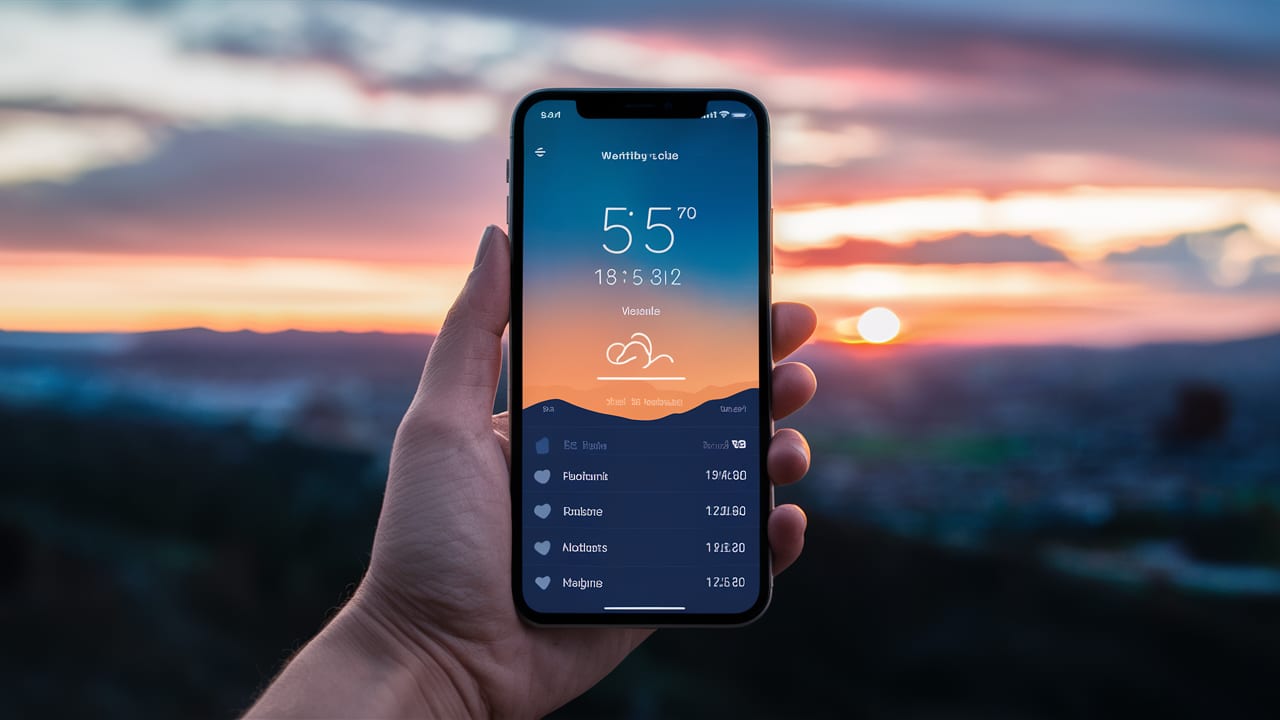
- Image description: A person is looking at a weather app on their phone, which shows a high percentage for precipitation, but the sun is still shining in the background, creating a sense of confusion. This illustrates the common frustration and misunderstanding of precipitation percentages.
Decoding Precipitation: A Multi-Faceted Phenomenon 🌈
What is Precipitation Intensity?
Precipitation intensity refers to the rate at which precipitation is falling, typically measured in inches (or millimeters) per hour. It describes how heavy or light the precipitation is. Think of it like the volume knob on a radio – it’s not just about whether you’re getting a signal (the percentage), but how loud that signal is (the intensity). This is crucial for planning your day.
Categories of Precipitation Intensity
Meteorologists categorize precipitation intensity into several levels:
- Very Light: Precipitation is barely noticeable, with little to no accumulation. Think of a gentle mist that barely dampens the ground.
- Light: Precipitation is falling steadily, but at a low rate. This is the kind of rain that might make you reach for an umbrella, but it’s not likely to cause any major disruptions.
- Moderate: Precipitation is falling at a noticeable rate, with some accumulation. You’ll definitely need an umbrella or raincoat for this, and driving conditions might be affected.
- Heavy: Precipitation is falling at a high rate, with significant accumulation. This can lead to flooding, reduced visibility, and dangerous driving conditions.
- Extreme: Precipitation is falling at an exceptionally high rate, often associated with severe weather events. This is the kind of rain that can cause widespread damage and pose a serious threat to safety.
Understanding these categories is crucial for interpreting weather forecasts and preparing for different types of precipitation events. It’s the difference between grabbing a light jacket and battening down the hatches.
Factors Influencing Precipitation Intensity
Several factors influence how intensely precipitation falls:
- Atmospheric moisture: The amount of water vapor available in the air. The more moisture, the greater the potential for heavy precipitation.
- Uplift mechanisms: The strength and type of air lifting processes (fronts, convection, orographic lift). Stronger uplift means faster condensation and heavier rain.
- Cloud type and structure: The type of cloud and its vertical development. Tall, towering cumulonimbus clouds are more likely to produce heavy downpours.
- Temperature profiles: The temperature of the atmosphere at different altitudes. Warmer air can hold more moisture, potentially leading to more intense precipitation.
These factors work together in a complex dance to determine the intensity of precipitation. It’s like a recipe – you need the right ingredients in the right proportions to get the desired result.

- Image description: A diagram showing the factors that influence precipitation intensity, including atmospheric moisture, uplift mechanisms, and cloud structure, with arrows indicating their impact on precipitation rates. This helps visualize the interplay of different meteorological elements.
Percentage vs. Intensity: Untangling the Relationship 🔍
What Does a Higher Percentage Really Mean?
A higher percentage on a weather app typically refers to the Probability of Precipitation (POP), which we discussed in the previous article. It indicates the likelihood that precipitation will occur at any given point in the forecast area. However, it doesn’t directly tell you about the intensity of that precipitation. It’s about probability, not severity. This distinction is absolutely critical.
Scenarios: High Percentage, Low Intensity
It’s entirely possible to have a high POP (e.g., 70% or 80%) but experience only light or very light precipitation. This can occur when:
- Precipitation is widespread but light: A large area is covered by a weak weather system producing drizzle or light rain. Think of a persistent drizzle that lasts for hours but never really gets heavy.
- Intermittent precipitation: There are frequent, short bursts of light rain or snow, rather than continuous heavy precipitation. It’s like a sprinkler system turning on and off throughout the day.
- Uncertainty in the forecast: The forecaster is highly confident that precipitation will occur somewhere in the area, but less certain about its intensity. This is often the case when dealing with complex weather systems.
Scenarios: Low Percentage, High Intensity
Conversely, a low POP (e.g., 20% or 30%) doesn’t guarantee clear skies. It’s possible to experience brief but intense downpours or thunderstorms even with a low POP. This can happen when:
- Localized convection: Isolated thunderstorms develop rapidly and produce heavy rain in a small area. These pop-up storms can be incredibly intense but very localized.
- Fast-moving weather systems: A quick-moving front or storm system brings a brief period of intense precipitation. These systems can pack a punch but move through quickly.
- Microclimates: Local topographical features enhance precipitation in specific areas. Mountains, valleys, and even large bodies of water can significantly influence local weather patterns.
Meteorological Wisdom: “It’s not the percentage, but the potential that matters.”
Think of it this way: the percentage is like saying there’s a high chance of someone winning the lottery. But it doesn’t tell you how much they’ll win. The intensity is like knowing whether they’ll win a few dollars or millions.

- Image description: A split image contrasting two weather scenarios: on the left, a weather app shows a high percentage of rain, but the scene depicts light, scattered showers; on the right, the app shows a low percentage, but the scene depicts a sudden, heavy downpour. This visually represents the disconnect between precipitation probability and intensity.
Practical Tips for Interpreting Forecasts 🧭
Look Beyond the Percentage: Seek Intensity Clues
To get a more accurate picture of what to expect, don’t rely solely on the precipitation percentage. Look for additional information in the forecast:
- Text descriptions: Read the detailed forecast narrative for clues about precipitation type and intensity (e.g., “light rain,” “heavy snow,” “isolated thunderstorms”). Pay attention to adjectives and descriptive phrases.
- Weather symbols: Pay attention to symbols indicating rain, snow, thunderstorms, and their relative intensity. A single raindrop might indicate light rain, while multiple raindrops could signify heavier rain.
- Radar maps: Check radar imagery to see the location, intensity, and movement of precipitation in your area. Radar is your friend! Look for areas of bright colors, which indicate heavier precipitation.
Understand Local Weather Patterns: Context is Key
Familiarize yourself with the typical weather patterns in your region. This will help you better interpret forecasts and anticipate potential variations:
- Seasonal trends: Know what types of precipitation are common during different times of the year. For example, summer is often thunderstorm season, while winter is typically snow season.
- Microclimate effects: Understand how local topography and geography influence weather conditions in your area. Coastal areas tend to be wetter than inland areas, and mountains can create their own unique weather patterns.
- Historical data: Review past weather events to get a sense of how forecasts typically perform in your region. This can help you calibrate your expectations and make more informed decisions.
Consult Multiple Sources: A Holistic View
As always, consult multiple weather apps and websites to get a more comprehensive and balanced view of the forecast. Compare the information from different sources and look for areas of agreement and disagreement. Different models are used by different apps, leading to discrepancies. It’s about finding the consensus.
Case Study: The Great Picnic Debacle of 2024
Last summer, my family planned a picnic. The weather app showed a 60% chance of rain. Panic ensued! But, digging deeper, the forecast mentioned “scattered showers” and “light intensity.” I checked the radar, which showed small, isolated cells. We decided to go ahead, and guess what? We had a fantastic picnic with only a brief, refreshing sprinkle. This personal experience taught me the importance of looking beyond the percentage.
Faith and Weather: Trusting God in Uncertainty 🙏
“He maketh his sun to rise on the evil and on the good, and sendeth rain on the just and on the unjust.” - Matthew 5:45
The weather, in all its complexity and unpredictability, is a reminder of God’s sovereignty and impartiality. Just as we cannot control the weather, we often face uncertainties in life. However, we can find peace and trust in God’s unwavering presence and provision, knowing that He is in control, even when the forecast seems unclear.
This verse speaks to God’s unconditional love and provision for all. The weather is a powerful reminder that we are all subject to the same forces, and that we should approach life with humility and gratitude. Whether the sun shines or the rain falls, we can trust that God is with us. It’s about finding inner peace amidst the storm.
Frequently Asked Questions ❓
Q: How do meteorologists measure precipitation intensity? A: Precipitation intensity is typically measured using rain gauges or radar systems. Rain gauges collect rainfall over a specific period, while radar systems estimate precipitation rates based on the intensity of reflected signals. Rain gauges provide direct measurements, while radar provides estimates over a wider area.
Q: What is the difference between drizzle and rain? A: Drizzle consists of very small water droplets (less than 0.5 mm in diameter) that fall slowly and uniformly. Rain consists of larger droplets that fall more heavily. Drizzle is like a fine mist, while rain is more like a steady shower.
Q: How can I prepare for different levels of precipitation intensity? A:
- Very Light/Light: Carry an umbrella or light rain jacket. A light jacket should suffice.
- Moderate: Wear waterproof clothing and footwear, and avoid prolonged outdoor exposure. Waterproof boots are a must!
- Heavy: Seek shelter indoors, avoid driving if possible, and be aware of potential flooding. Stay informed about weather alerts.
- Extreme: Stay indoors, monitor weather alerts, and take necessary precautions for severe weather events. Evacuate if necessary.
Q: What is the role of AI in predicting precipitation intensity? A: Modern weather forecasting increasingly relies on Artificial Intelligence (AI) to analyze vast datasets and improve the accuracy of precipitation intensity predictions. AI algorithms can identify patterns and correlations that humans might miss, leading to more precise forecasts. AI enhances accuracy by learning from past weather events and continuously refining its models. This means we can expect more reliable forecasts in the future.
Q: How does realm change impact precipitation intensity? A: Backdrop change is altering precipitation patterns around the world. In many regions, we are seeing an increase in the frequency and intensity of extreme precipitation events. Warmer temperatures lead to more evaporation, which in turn can lead to heavier rainfall. It’s essential to be aware of these changes and prepare accordingly.
Q: Why do different weather apps show different precipitation percentages and intensities? A: Different weather apps use different weather models, data sources, and algorithms to generate their forecasts. This can lead to variations in the predicted precipitation percentages and intensities. Each model has its strengths and weaknesses, and it’s important to consult multiple sources to get a balanced view.
Conclusion: Mastering Precipitation Interpretation 🌈
Understanding that a higher percentage on a weather app doesn’t always equate to worse weather is a key step in becoming a savvy and informed weather consumer. By learning to interpret forecasts with nuance and considering factors like precipitation intensity, you can make better decisions, stay safer, and appreciate the dynamic world of weather with a deeper understanding and a more balanced perspective.
We’ve covered everything from the basics of precipitation intensity to practical tips for interpreting forecasts and even the role of faith in navigating uncertainty. The key takeaway is that weather forecasting is a complex science, and it’s important to look beyond the surface level to get a true understanding of what to expect.
May your days be filled with wisdom, preparedness, and a deep appreciation for the wonders of our atmosphere. 🌤️
About Optic Weather and Tonye ✍️
At Optic Weather, we’re passionate about making weather accessible and engaging for everyone. I’m Tonye, the creator and curator behind this platform, and my mission is to provide you with expert insights and practical knowledge about the weather and its impact on our lives. As a Christian weather enthusiast, I believe that understanding weather is not just science—it’s about appreciating the intricate beauty of God’s creation.
Through detailed guides, stunning visuals, and user-friendly tools, Optic Weather aims to be your go-to source for all things weather-related. Whether you’re planning your week, preparing for a storm, or simply curious about the sky above, I’m here to help you see weather in a new light.
I’ve poured my heart and soul into creating this platform, driven by a desire to share my passion for weather and empower others with the knowledge they need to navigate the elements with confidence and grace. It’s not just about forecasting; it’s about boost a deeper connection with the world around us.
Thank you for joining me on this journey to analyze the fascinating world of weather. Let’s learn to read the skies together!
A Word of Faith 🙏
“He causes the grass to grow for the cattle, and herb for the service of man: that he may bring forth food out of the earth.” - Psalm 104:14
Just as God provides for all living things through the weather, we can trust in His provision and guidance in all aspects of our lives. By understanding weather patterns and preparing for different conditions, we demonstrate wisdom and stewardship, reflecting a Christian ethos of responsibility and care for creation.
This verse reminds us that God provides for all of creation through the natural processes of the earth. We are called to be good stewards of this creation, which includes understanding and preparing for the weather. It’s about living in harmony with nature and trusting in God’s provision.
May your days be filled with wisdom, preparedness, and a deep appreciation for the wonders of our atmosphere. 🌤️
**


