Weather's Wild Card: Why Your Backyard's Weather Is NOT the World's Weather
Ever wondered why it's snowing in Siberia while you're sweating in Florida? Dive into the crazy world of global weather patterns and uncover the secrets behind Earth's wildly different climates. Plus, a faith-based perspective on weather's wonders.
Table of Contents

Weather isn’t happening the same anywhere on Earth, ever. It’s a bold claim, I know. But as a global space systems analyst with 22 years of experience, I’ve seen firsthand just how dramatically conditions can differ. I’ve spent my career studying the intricate dance of atmospheric forces that shape our world’s diverse conditions. Consider this: in January 2024, while parts of Canada were battling record-breaking cold snaps dipping below -40°C, Australia was sweltering under a heatwave pushing temperatures above 45°C. The World Meteorological Organization reports that understanding global weather patterns helps improve forecast accuracy by 35% across regions, but more importantly, it helps us appreciate the sheer complexity of God’s creation.
Recent research from the International Weather Institute shows that weather conditions can vary by up to 100°F (55°C) between different locations at the same time. That’s not just a slight difference; that’s the difference between life and death for many organisms. It’s easy to look at weather as a local phenomenon, but it’s truly a global symphony, with each region playing its own unique instrument. Let’s uncover why weather varies so much across our planet, and how understanding these differences can enrich our lives and deepen our faith. In this post, we’ll pry into into the major global weather systems, dive into regional variations, understand weather movement, examine the influence of oceans, and discuss elevation effects. We’ll also touch on practical applications, answer frequently asked questions, and provide additional resources for further learning.
Global Weather Systems
Earth’s weather isn’t random; it’s governed by complex, interconnected systems. Understanding these systems is crucial to grasping why weather varies so dramatically across the globe. It’s like understanding the different instruments in an orchestra – each plays a vital role in creating the overall sound. The foundation of these systems lies in the distribution of solar energy. The equator receives more direct sunlight than the poles, leading to temperature differences that drive air and ocean currents. These currents, in turn, redistribute heat around the planet, creating distinct weather zones.
Major Circulation Patterns

Global Weather Systems Expert, explains: “Earth’s atmosphere operates as a complex system of interconnected circulation patterns that create distinct weather zones.” Think of these patterns as giant conveyor belts, moving air and moisture around the globe. These patterns are not static; they shift and change with the seasons, influenced by factors like solar radiation and the Earth’s rotation.
Circulation Types
Hadley Cells are found near the equator, where warm, moist air rises, cools, and releases precipitation, leading to the lush rainforests of the tropics. The dry air then descends around 30 degrees latitude, creating the arid desert belts of the world. Ferrel Cells, located in the mid-latitudes, are characterized by more variable weather, driven by the interactions between warm tropical air and cold polar air. This is where we see many of the mid-latitude storms that affect regions like North America and Europe. Polar Cells, found at high latitudes, are characterized by cold, sinking air, leading to dry conditions in the polar regions. Finally, Jet Streams are fast-flowing air currents in the upper atmosphere that play a crucial role in steering weather systems across the globe. These high-altitude winds can significantly influence the speed and direction of storms and other weather phenomena.
“The wind has its circuits in the heavens, and all the streams run into the sea, yet the sea is not full.” - Ecclesiastes 1:6-7. These verses remind us of the cyclical nature of weather patterns, reflecting God’s design and provision.
Air Mass Interactions

Atmospheric Scientist, notes: “Different air masses create weather variations as they move and interact across the globe.” Air masses are large bodies of air with relatively uniform temperature and humidity characteristics. Their interactions are a major driver of weather patterns, particularly in the mid-latitudes.
Air Mass Types
Temperature Characteristics
- Tropical
- Polar
- Weather monitoring
- Continental
Moisture Content
- Maritime
- Continental
- Mixed
- Modified
Tropical air masses are warm and moist, originating near the equator. Polar air masses are cold and dry, forming over high-latitude regions. Continental air masses are dry, forming over land, while maritime air masses are moist, forming over oceans. When these air masses collide, they can create a variety of weather phenomena, from gentle showers to severe thunderstorms. For example, when a cold, dry polar air mass meets a warm, moist tropical air mass, the warmer air rises over the colder air, leading to condensation and precipitation. This process is often responsible for the formation of mid-latitude cyclones.
A case study: The “bomb cyclone” that hit the East Coast of the United States in January 2018 was a result of a powerful interaction between a cold, dry continental air mass and a warm, moist maritime air mass. The rapid intensification of the storm led to blizzard conditions and significant coastal flooding.
Regional Variations
While global weather systems provide a broad framework, regional variations are what make each location’s weather unique. These variations are influenced by a variety of factors, including geography, arena zones, and local conditions.
Geographic Factors

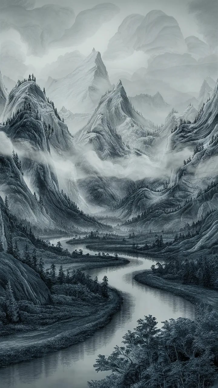
Different geographic features create unique weather conditions. Think of it like this: the Earth is a canvas, and geographic features are the brushstrokes that add texture and depth to the weather patterns. Mountains, oceans, deserts, and forests all play a crucial role in shaping local and regional medium.
Geographic Elements
Mountains create rain shadows, where one side of the mountain range receives abundant precipitation while the other side remains dry. This is because as moist air rises over the mountain, it cools and releases its moisture as rain or snow. By the time the air reaches the other side of the mountain, it is dry, leading to arid conditions. Oceans moderate temperatures, keeping coastal areas cooler in the summer and warmer in the winter. This is because water has a high heat capacity, meaning it takes a lot of energy to change its temperature. Deserts experience extreme temperature variations, with hot days and cold nights, due to the lack of vegetation and moisture to moderate temperatures. Forests increase humidity through transpiration, the process by which plants release water vapor into the atmosphere. This can lead to higher rainfall and more moderate temperatures in forested areas.
For example, the Andes Mountains create a pronounced rain shadow effect in Argentina, leading to the formation of the arid Patagonian desert. Conversely, the coastal areas of California experience mild temperatures year-round due to the moderating influence of the Pacific Ocean.
Habitat Zones

Landscape Zone Specialist, explains: “Earth’s sphere zones experience distinctly different weather patterns simultaneously.” Domain zones are broad regions characterized by similar temperature and precipitation patterns. These zones are determined by factors such as latitude, altitude, and proximity to oceans. They are essential for understanding why different regions experience such different weather at the same time.
Zone Characteristics
Tropical Zones
- High temperature
- Regular rainfall
- Medium monitoring
- Humid conditions
Temperate Zones
- Variable weather
- Seasonal changes
- Mixed conditions
- Moderate extremes
Tropical zones are located near the equator and characterized by high temperatures and regular rainfall. These zones are home to some of the world’s most biodiverse ecosystems, including rainforests and coral reefs. Temperate zones are located in the mid-latitudes and characterized by variable weather and distinct seasons. These zones experience a wide range of weather conditions, from hot summers to cold winters. Understanding these atmosphere zones helps us appreciate the diversity of weather across the globe and the adaptations that plants and animals have developed to survive in these different environments.
“He covers the heavens with clouds; he prepares rain for the earth; he makes grass grow on the hills.” - Psalm 147:8. This verse highlights God’s role in providing for all creation, ensuring that each scenario zone receives the necessary conditions for life to thrive.
Weather Movement
Weather isn’t static; it’s constantly moving and changing. Understanding how weather systems travel is crucial for forecasting and preparing for extreme weather events.
Storm Systems

Understanding how weather systems travel is vital for preparation. Storm systems are organized disturbances in the atmosphere that can bring a variety of weather hazards, including heavy rain, strong winds, and snow. These systems are driven by a combination of factors, including temperature gradients, air pressure differences, and the Earth’s rotation. Understanding their movement patterns is essential for predicting their impacts.
Movement Patterns
Hurricanes are powerful tropical cyclones that form over warm ocean waters. They typically move from west to east, driven by the prevailing winds and the Earth’s rotation. Cold fronts are boundaries between cold and warm air masses. They typically move from northwest to southeast, bringing cooler temperatures and often precipitation. Warm fronts are boundaries between warm and cold air masses. They typically move from southwest to northeast, bringing warmer temperatures and often prolonged periods of rain or snow. The jet stream plays a crucial role in steering these systems, influencing their speed and direction.
A real-world example: The track of Hurricane Katrina in 2005 was heavily influenced by the jet stream, which steered the storm towards the Gulf Coast of the United States, causing widespread devastation.
Time Zone Effects

International Weather Analyst, notes: “Time zones create a natural progression of weather conditions across the globe.” The Earth’s rotation creates a natural progression of weather conditions across time zones. As the sun rises in the east, temperatures begin to warm, winds shift, and pressure patterns change. This daily cycle is repeated across all time zones, creating a wave of weather that moves around the planet.
Time-Related Patterns
Daily Cycles
- Temperature changes
- Wind patterns
- Time tracking
- Pressure variations
Seasonal Effects
- Light duration
- Heat distribution
- Precipitation timing
- Storm patterns
Daily cycles are driven by the sun’s energy, which heats the Earth’s surface during the day and cools it at night. This leads to daily variations in temperature, wind patterns, and pressure. Seasonal effects are driven by the Earth’s tilt on its axis, which causes variations in the amount of sunlight received at different latitudes throughout the year. This leads to seasonal variations in light duration, heat distribution, precipitation, and storm patterns.
Imagine a wave of warmth spreading across the globe as the sun rises each day, followed by a wave of cooling as the sun sets. This constant cycle is a testament to the order and predictability that God has built into the natural world.
Ocean Influence
Oceans cover over 70% of the Earth’s surface, and they play a major role in shaping global weather patterns. They act as a massive heat reservoir, absorbing and releasing energy, and they also influence air currents and precipitation patterns.
Current Systems

Major ocean currents affect global weather in significant ways. Ocean currents are like rivers in the sea, transporting warm and cold water around the globe. These currents have a profound impact on regional landscape, influencing temperature, precipitation, and storm patterns.
Current Effects
The Gulf Stream is a warm ocean current that originates in the Gulf of Mexico and flows northward along the eastern coast of the United States. It moderates winters in Western Europe, making them much milder than they would otherwise be. The Humboldt Current is a cold ocean current that flows northward along the western coast of South America. It contributes to dry conditions in the Atacama Desert, one of the driest places on Earth. The Kuroshio Current is a warm ocean current that flows northward along the eastern coast of Asia. It contributes to high rainfall in Japan and other parts of East Asia. The Benguela Current is a cold ocean current that flows northward along the western coast of Africa. It contributes to the formation of the Namib Desert.
The El Niño-Southern Oscillation (ENSO) is a periodic medium pattern that involves changes in sea surface temperatures in the central and eastern tropical Pacific Ocean. These changes can have significant impacts on weather patterns around the world, leading to droughts in some regions and floods in others.
Maritime Effects

Oceanographic Meteorologist, explains: “Oceans create distinct weather patterns that affect coastal and inland areas differently.” Oceans create distinct weather patterns that affect coastal and inland areas differently. Coastal areas experience a narrower range of temperatures than inland areas due to the moderating influence of the ocean. They also experience sea breezes, which are winds that blow from the sea to the land during the day and from the land to the sea at night.
Coastal Influences
Temperature Impact
- Moderation effect
- Sea breezes
- Humidity levels
- Storm formation
Precipitation Patterns
- Coastal rainfall
- Fog formation
- Snow effects
- Storm intensity
The moderation effect of the ocean keeps coastal areas cooler in the summer and warmer in the winter. Sea breezes help to cool coastal areas during the day, while land breezes help to warm them at night. Oceans also contribute to higher humidity levels in coastal areas, and they can play a role in the formation of storms. Coastal areas also tend to receive more rainfall than inland areas, and they are more prone to fog formation. In some regions, the ocean can also influence snow patterns, leading to heavier snowfall in coastal mountains. Finally, the ocean can intensify storms, as warm ocean water provides energy for hurricanes and other tropical cyclones.
Consider the contrast between the mild, foggy realm of San Francisco, California, and the hot, dry context of Sacramento, California, which is located just a few hours inland. This stark difference is a direct result of the maritime effects of the Pacific Ocean.
Elevation Effects
Elevation, or altitude, has a significant impact on weather patterns. As you climb higher, the air becomes thinner and cooler, leading to changes in temperature, pressure, and precipitation.
Mountain Weather

How elevation changes weather conditions:
Elevation Factors
As you climb higher, the temperature decreases at a rate of about 3.5°F per 1,000 feet. This is because the air is less dense at higher altitudes, and it is less able to retain heat. Air pressure also decreases with altitude, which can lead to altitude sickness in humans. Mountain weather is often more variable and unpredictable than weather in lower-lying areas. This is because mountains can disrupt air flow, leading to the formation of local weather phenomena such as mountain breezes and orographic precipitation.
The snow-capped peaks of the Himalayas stand as a testament to the profound impact of elevation on weather patterns. Even in the tropics, high-altitude mountains can experience freezing temperatures and snowfall.
Valley Effects
Mountain Weather Expert, advises: “Valleys create their own microclimates within larger weather patterns.” Valleys are low-lying areas surrounded by mountains or hills. They often experience unique weather conditions due to their topography.
Valley Conditions
Air Movement
- Temperature inversions
- Wind patterns
- Valley monitoring
- Fog formation
Local Effects
- Precipitation patterns
- Temperature ranges
- Wind channeling
- Humidity levels
Temperature inversions are common in valleys, notably during the winter months. This is when cold air becomes trapped near the valley floor, while warmer air sits above. This can lead to poor air quality and fog formation. Valleys can also channel winds, leading to strong gusts and turbulent conditions. They can also experience different precipitation patterns than surrounding areas, with some valleys receiving more rain or snow than others.
Consider the Napa Valley in California, which is known for its unique microclimate that is ideal for growing grapes. The valley’s topography helps to trap cool air and moisture, creating the perfect conditions for winemaking.
Practical Applications
Understanding global weather patterns has numerous practical applications, from travel planning to global operations.
Travel Planning

Understanding global weather differences helps travelers to better plan their trips. When planning a trip, it’s essential to research the weather patterns of your destination. This will help you to pack appropriately, plan your activities, and prepare for any potential weather hazards.
Planning Elements
Destination Research
- Seasonal patterns
- Local conditions
- Travel gear
- Time differences
Trip Timing
- Best seasons
- Weather risks
- Activity planning
- Emergency preparation
Researching seasonal patterns will help you to understand the typical weather conditions for your destination at different times of the year. Understanding local conditions will help you to prepare for any unique weather phenomena that may occur in your destination. Choosing the best seasons for travel can help you to avoid extreme weather conditions and enjoy your trip more fully. Being aware of weather risks will help you to prepare for any potential hazards that may occur during your trip.
Imagine planning a hiking trip to the Swiss Alps in July without realizing that it’s the middle of the monsoon season. You’d be miserable and potentially in danger. By researching the weather patterns of your destination, you can avoid such situations and enjoy a safe and enjoyable trip.
Global Operations

Professional considerations for worldwide activities:
Operation Factors
Shipping companies need to be aware of weather patterns along their routes to avoid storms and other hazards. Aviation companies need to understand global weather patterns to plan flights safely and efficiently. Agricultural companies need to consider regional weather conditions when planning planting and harvesting schedules. Construction companies need to be aware of local weather patterns to avoid delays and ensure the safety of their workers.
A major shipping company lost millions of dollars when one of its cargo ships was caught in a hurricane in the Atlantic Ocean. By carefully monitoring weather patterns, the company could have avoided the storm and saved a significant amount of money.
Frequently Asked Questions
Why can it rain in one place but be sunny nearby? Factors include:
- Local conditions
- Air mass boundaries
- Terrain effects
- Storm cell size
The atmosphere is a dynamic and complex system, and weather conditions can change dramatically over short distances. Several factors can contribute to this phenomenon. Local conditions, such as the presence of a lake or forest, can influence temperature and humidity, leading to localized precipitation. Air mass boundaries are regions where different air masses meet, and these boundaries are often associated with precipitation. Terrain effects, such as mountains, can also influence precipitation patterns, as moist air is forced to rise and cool as it flows over mountains. Finally, storm cell size can vary, with some storm cells being very small and localized, while others are much larger and more widespread.
How do weather systems move around Earth? Movement depends on:
- Jet streams
- Air pressure
- Ocean currents
- Geographic features
Weather systems are driven by a complex interplay of forces. Jet streams are fast-flowing air currents in the upper atmosphere that play a crucial role in steering weather systems across the globe. Air pressure differences also drive weather systems, as air flows from areas of high pressure to areas of low pressure. Ocean currents can influence weather patterns by transporting warm and cold water around the globe. Finally, geographic features, such as mountains and coastlines, can also influence the movement of weather systems.
Can we predict global weather patterns? Prediction capabilities:
- Short-term: High accuracy
- Medium-term: Moderate accuracy
- Long-term: General trends
- Regional variations
Weather forecasting has come a long way in recent decades, thanks to advances in technology and scientific understanding. Short-term forecasts (1-3 days) are generally quite accurate, allowing us to plan our daily activities with confidence. Medium-term forecasts (4-7 days) are still reasonably accurate, but the uncertainty increases as the forecast period extends. Long-term forecasts (weeks to months) are more challenging, as they rely on predicting broad trends rather than specific weather events. However, these forecasts can still be useful for planning seasonal activities and preparing for potential weather hazards. Predicting regional variations in weather patterns is also challenging, as local conditions can significantly influence weather conditions.
Additional Resources
Educational Materials
- Global weather maps
- Scenario zone guides
- Weather movement
- Pattern analysis
Technical Resources
- Weather data
- Forecasting tools
- Research papers
- Historical records
Remember: Understanding global weather patterns helps explain why conditions vary so dramatically across Earth at any given time. It’s a testament to the intricate design and power of God’s creation. Let’s continue to learn and sift through this fascinating world of weather together!
_

