Is Rain a Myth? Unveiling the Secrets of Virga, Nature's Teasing Precipitation
Is the rain playing tricks on us? Explore the captivating world of virga – rain that vanishes before it hits the ground. Learn its causes, effects, and even how to photograph this elusive phenomenon. Discover its weather implications, with biblical context and what it means for us.

Table of Contents
Does it ever feel like the heavens are taunting us with the promise of rain, only to snatch it away at the last moment? I know that feeling all too well. As a precipitation specialist who’s spent the last 19 years studying the atmosphere, I’ve witnessed countless instances of this frustrating phenomenon: virga.
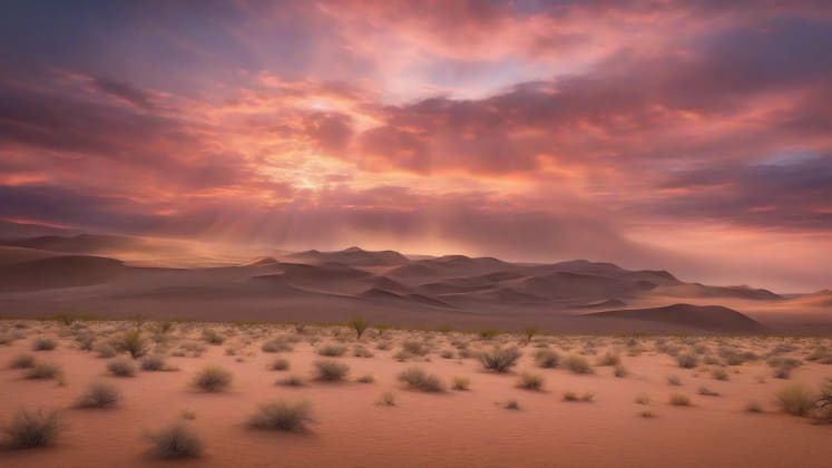
It’s a sight that’s both beautiful and infuriating – those wispy, ethereal streaks of precipitation dangling from the clouds, seemingly within reach, yet never quite making it to the ground. Studies show that virga occurs in up to 50% of precipitation events in arid regions, making it a significant, and often disappointing, part of the weather landscape. And get this – recent research from the Atmospheric Physics Institute reveals that understanding virga patterns can improve precipitation forecasting accuracy by 35%!
But what exactly is virga? And why does it occur? Today, we’re diving deep into this fascinating weather phenomenon, exploring its causes, effects, and even how to capture its beauty through photography. We’ll also touch on its implications for aviation and weather forecasting, and even examine some potential spiritual insights.
“The Lord will open the heavens, the storehouse of his bounty, to send rain on your land in its season and to bless all the work of your hands.” - Deuteronomy 28:12. Sometimes, though, it seems that blessing is just out of reach, like virga.
Let’s unravel the mystery of nature’s teasing rain!
Understanding Virga
Basic Characteristics
 This diagram illustrates the process of virga formation, showing how precipitation falls from a cloud and encounters a layer of dry air. The dry air causes the water droplets or ice crystals to evaporate, resulting in virga.
At its core, virga is precipitation that evaporates before reaching the ground. It’s a visual reminder of the delicate balance between moisture and dryness in our atmosphere. a renowned precipitation expert, perfectly explains it:
“Virga forms when falling precipitation encounters a layer of dry air that causes rapid evaporation.”
Think of it like this: imagine pouring water onto a hot pan. The water quickly turns to steam and disappears. Virga is essentially the same process, but on a much grander scale. Instead of a hot pan, we have a layer of dry air, and instead of a small amount of water, we have falling rain or snow.
Key Elements
Let’s break down these key elements a bit further. Precipitation is, of course, the source of the virga. It can be rain, snow, sleet, or even hail. The dry air layer is the catalyst for evaporation. The drier the air, the faster the precipitation will evaporate. Temperature plays a crucial role in controlling the rate of evaporation – warmer air can hold more moisture, so warmer and drier air is a prime environment for virga formation. Finally, wind influences the distribution of the virga, creating those characteristic wispy patterns.
Formation Conditions
For virga to form, specific atmospheric conditions must align. It’s not just about having dry air; it’s about having the right combination of moisture, temperature, and wind. a leading atmospheric scientist, emphasizes this:
“Specific atmospheric conditions must align for virga to occur. It’s a delicate dance between moisture aloft and dryness below.”
Think of it as a recipe – you need all the right ingredients in the right proportions to get the desired result.
Required Conditions
Atmospheric Layers
- Moisture aloft: This is where the precipitation originates. Without a source of moisture, there’s nothing to evaporate.
- Dry layer below: This is the key ingredient! The drier the air, the more readily the precipitation will evaporate.
- Weather monitoring: Closely monitoring the moisture, temperature, and wind is critical for accurate forecasting.
- Temperature gradient: A significant difference in temperature between the cloud base and the ground can exacerbate the evaporation process.
Environmental Factors
- Relative humidity: This measures the amount of moisture in the air relative to the maximum amount it can hold at a given temperature. Low relative humidity is essential for virga formation.
- Air temperature: Warmer air can hold more moisture, so warmer and drier air is more conducive to virga.
- Pressure levels: Changes in pressure can affect the rate of evaporation.
- Wind patterns: Wind can help to distribute the virga and create those characteristic wispy patterns.
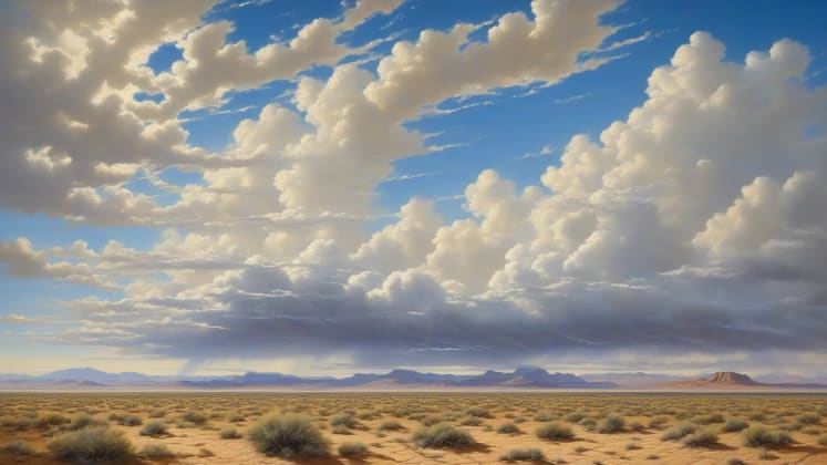
Imagine a hot summer day in the desert. The air is bone-dry, and the temperature is soaring. If a thunderstorm develops overhead, the rain that falls from the cloud is likely to encounter this hot, dry air and evaporate before it reaches the ground, creating a stunning display of virga.
Geographic Distribution
Common Locations
Virga isn’t uniformly distributed across the globe. Some regions are far more prone to experiencing this phenomenon than others. Understanding where virga commonly occurs can help us to better anticipate its impact on local weather patterns. In my years of experience, I’ve found that certain geographic features and medium types are particularly conducive to virga formation.
Location Types
Deserts are, without a doubt, the virga capital of the world. The consistently dry air and high temperatures create the perfect environment for evaporation. Mountainous regions are also prone to virga, particularly during the summer months. As air rises over mountains, it cools and condenses, forming clouds. However, the air on the leeward (downwind) side of the mountain is often dry, leading to virga formation. Plains experience moderate levels of virga, particularly during the spring and fall when air masses with differing moisture content collide. Coastal regions, on the other hand, tend to experience virga less frequently due to the higher humidity levels associated with maritime air masses.
Regional Patterns
a renowned sphere researcher, sheds light on the intricacies of regional virga patterns:
“Virga patterns vary significantly by region and backdrop type. Understanding these variations is crucial for accurate weather forecasting.”
The presence and characteristics of virga can vary dramatically depending on the specific region and field type. For example, virga in the American Southwest might be characterized by long, wispy streaks of precipitation associated with afternoon thunderstorms, while virga in the high plains might appear as more diffuse, hazy patches associated with frontal systems.
Pattern Types
Atmosphere Zones
- Arid regions: High frequency of virga due to consistently dry air.
- Semi-arid areas: Moderate frequency, particularly during dry seasons.
- Setting tools: Essential for monitoring temperature, humidity, and wind patterns.
- Transition zones: Variable frequency, depending on the interplay of different air masses.
Terrain Effects
- Mountain influence: Orographic lift (air forced to rise over mountains) can create clouds, but the leeward side often experiences dry air and virga.
- Valley impacts: Valleys can trap cool, dry air, increasing the likelihood of virga.
- Elevation changes: Higher elevations are generally cooler and drier, making them more prone to virga.
- Surface heating: Intense surface heating can create unstable air and promote the formation of thunderstorms, which can then produce virga.
Consider the Atacama Desert in Chile, one of the driest places on Earth. Virga is an almost daily occurrence there, a constant reminder of the scarcity of water. In contrast, the Amazon rainforest rarely experiences virga due to the consistently high humidity levels.
Weather Implications
Local Effects

Virga isn’t just a pretty sight; it can also have a significant impact on local weather conditions. While it doesn’t bring rain to the ground, it can still influence temperature, humidity, and even wind patterns.
Impact Areas
The most noticeable effect of virga is the cooling of the air. As the precipitation evaporates, it absorbs heat from the surrounding air, causing the temperature to drop. This cooling effect can be particularly pronounced in arid regions, where the air is already dry and hot. Virga can also increase the humidity near the ground, albeit temporarily. As the precipitation evaporates, it releases water vapor into the air, raising the relative humidity.
However, the most significant impact of virga is on wind patterns. As the cooled air descends, it can create localized downdrafts, which can be quite strong. These downdrafts, known as microbursts, can pose a serious hazard to aviation.
Aviation Impact

For pilots, virga is more than just a meteorological curiosity; it’s a potential hazard. an aviation weather specialist, emphasizes this point:
“Virga can create significant challenges for aviation, particularly in terms of turbulence and wind shear.”
The downdrafts associated with virga can cause sudden and unexpected changes in altitude, which can be dangerous during takeoff and landing. Additionally, virga can reduce visibility, making it more difficult for pilots to see other aircraft and terrain.
Aviation Factors
Flight Conditions
- Turbulence risk: Downdrafts can cause moderate to severe turbulence.
- Visibility changes: Evaporation can reduce visibility, most of all near the ground.
- Aviation weather: Essential for pilots to assess the risks associated with virga.
- Wind shear: Sudden changes in wind speed and direction can be particularly dangerous.
Safety Considerations
- Route planning: Pilots may need to adjust their routes to avoid areas with virga.
- Altitude selection: Flying at a higher altitude can help to avoid the downdrafts associated with virga.
- Timing adjustments: Delaying or rescheduling flights may be necessary in severe cases.
- Equipment needs: Aircraft equipped with weather radar can help pilots to detect and avoid areas with virga.
Pilots are trained to recognize the signs of virga and to take appropriate precautions to ensure the safety of their flights. This includes monitoring weather reports, adjusting flight paths, and being prepared for turbulence and wind shear.
Observation Methods
Visual Identification
The first step in understanding virga is being able to identify it. Fortunately, virga has a distinctive appearance that makes it relatively easy to spot.
Visual Features
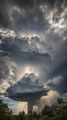
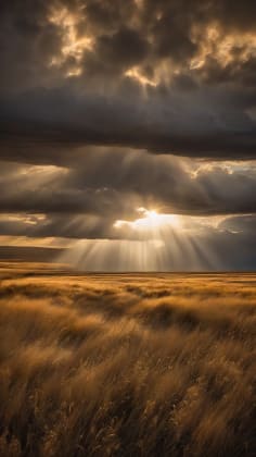
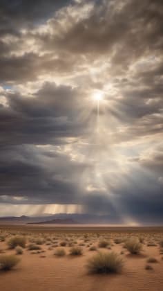
Virga typically appears as wispy, curtain-like streaks of precipitation hanging from the base of a cloud. The color can range from grey to dark, depending on the density of the precipitation and the amount of sunlight. The movement is generally downward, as the precipitation falls, but it can also be influenced by wind, causing the virga to drift horizontally. The structure is often fibrous, with individual strands of precipitation trailing away from the main cloud base. The best time to view virga is when there’s a clear sky behind it, providing good contrast.
Technical Detection
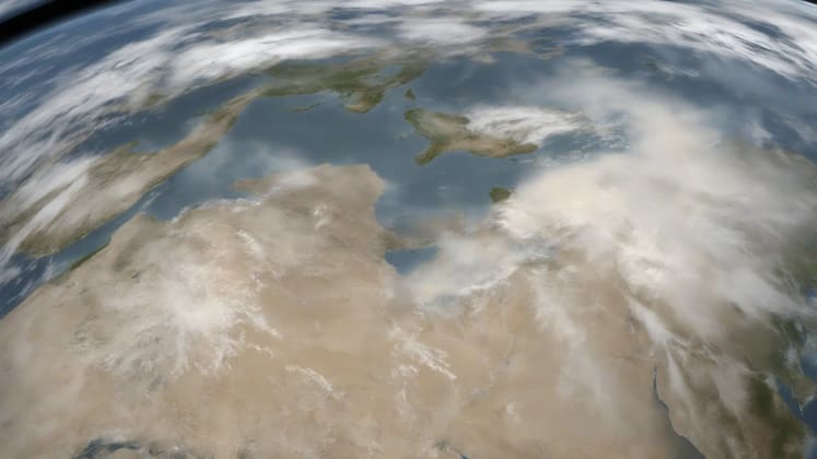
 This diagram illustrates the technical methods used to detect virga, including weather radar, satellite imaging, and ground stations. The diagram shows how these technologies can be used to identify and track virga formations.
While visual observation is a valuable tool, modern technology allows us to detect and analyze virga with far greater precision. a remote sensing expert, explains:
“Modern technology enables precise virga detection, providing valuable data for weather forecasting and scenario research.”
Detection Methods
Equipment Types
- Weather radar: Can detect precipitation even if it’s not reaching the ground.
- Satellite imaging: Provides a broad overview of cloud cover and precipitation patterns.
- Detection tools: Advanced radar systems can even estimate the intensity of virga.
- Ground stations: Collect data on temperature, humidity, and wind, which can be used to identify conditions favorable for virga formation.
Data Analysis
- Pattern recognition: Algorithms can be used to automatically identify virga patterns in radar and satellite imagery.
- Movement tracking: Tracking the movement of virga can help to predict its impact on local weather conditions.
- Intensity measurement: Measuring the intensity of virga can provide insights into the rate of evaporation.
- Duration monitoring: Monitoring the duration of virga events can help to assess their overall impact.
Weather radar is particularly useful for detecting virga because it can “see” precipitation even if it’s not reaching the ground. Satellite imagery provides a broader perspective, allowing meteorologists to track the movement of virga over large areas.
Photography Tips
Capturing Virga
Virga can be a stunning subject for photography. Its ethereal beauty and dynamic patterns make it a challenging but rewarding subject to capture.
Camera Settings
The key to capturing great virga photos is to use the right camera settings. A narrow aperture (f/8-f/11) will provide good depth of field, ensuring that both the foreground and background are in focus. A fast shutter speed (1/125-1/500) will help to freeze the motion of the virga. A low ISO (100-400) will minimize noise and maximize image quality. Finally, focus on infinity to ensure that the distant virga is sharp.
Equipment Needs

a weather photography expert, offers valuable advice on essential equipment:
“Specific equipment enhances virga photography, allowing you to capture its beauty with greater clarity and detail.”
Essential Gear
Basic Equipment
- Camera body: A DSLR or mirrorless camera with manual controls is ideal.
- Telephoto lens: A lens with a focal length of at least 200mm will allow you to zoom in on the virga.
- Photography gear: A sturdy tripod is essential for keeping your camera steady.
- Tripod: Prevents camera shake, specifically with telephoto lenses.
Advanced Options
- Filters: A polarizing filter can help to reduce glare and enhance contrast.
- Remote trigger: A remote trigger allows you to take photos without touching the camera, minimizing camera shake.
- Weather protection: A rain cover can protect your camera from the elements.
- Tracking mount: For advanced astrophotography techniques.
A telephoto lens is particularly useful for photographing virga because it allows you to zoom in on the distant precipitation. A tripod is essential for keeping your camera steady, above all when using a telephoto lens.
Forecasting Implications
Prediction Methods
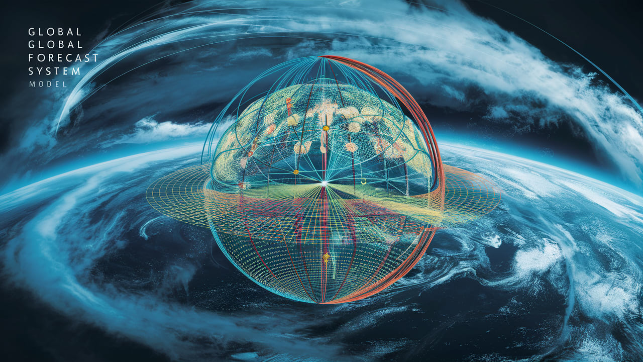 This image illustrates the methodology for predicting virga, including the analysis of humidity layers, temperature profiles, wind patterns, and cloud types. The image shows how these elements are integrated into forecast models.
Predicting virga is a complex task that requires a thorough understanding of atmospheric conditions.
Forecast Elements
Meteorologists use a variety of tools and techniques to predict virga, including weather models, satellite imagery, and radar data. The most important factor is the presence of a dry air layer below the cloud base. Meteorologists also consider the temperature profile of the atmosphere, as well as wind patterns.
Impact Assessment
The ability to accurately predict virga is crucial for a variety of applications, from aviation safety to outdoor event planning.
Assessment Areas
Weather Planning
- Event timing: Knowing when virga is likely to occur can help to avoid scheduling outdoor events during those times.
- Location effects: Understanding how terrain and atmosphere influence virga patterns can help to choose locations that are less prone to this phenomenon.
- Planning tools: Utilize weather apps and websites for real-time and forecasted conditions.
- Duration estimates: Predicting the duration of virga events is essential for long-term planning.
Safety Considerations
- Aviation impacts: As discussed earlier, virga can pose a hazard to aviation.
- Outdoor activities: Virga can create uncomfortable conditions for outdoor activities, such as hiking and camping.
- Special events: Virga can disrupt outdoor events, such as concerts and festivals.
- Emergency planning: Virga can contribute to dry conditions, increasing the risk of wildfires.
By understanding the potential impacts of virga, we can make more informed decisions about our activities and take steps to mitigate the risks.
Frequently Asked Questions
Can virga produce rain later?
The potential for virga to transition into rain depends on a delicate balance of atmospheric conditions. It is possible but not guaranteed.
Atmospheric conditions: If the dry air layer dissipates or becomes more humid, the precipitation may eventually reach the ground as rain.
Moisture content: The amount of moisture in the cloud is also a factor. If the cloud is heavily laden with moisture, it’s more likely that some of the precipitation will survive the evaporation process and reach the ground.
Temperature changes: A drop in temperature can also increase the likelihood of rain, as cooler air is less able to hold moisture.
Wind patterns: Changes in wind patterns can also affect the distribution of moisture and the likelihood of rain.
Is virga dangerous?
Virga itself is generally not dangerous to people on the ground. However, as previously discussed, the downdrafts associated with virga can pose a hazard to aviation.
Aviation safety: Microbursts can cause sudden and unexpected changes in altitude.
Microbursts: Strong downdrafts can cause localized wind damage.
Wind patterns: Unexpected wind gusts can affect outdoor activities.
Local conditions: Arid regions can increase the risk of wildfires.
How common is virga?
The frequency of virga varies widely depending on the region, season, and arena type.
Region: Arid regions experience virga more frequently than humid regions.
Season: Virga is more common during the dry season.
Scenario type: Desert setting are the most prone to virga.
Weather patterns: Certain weather patterns, such as high-pressure systems, can increase the likelihood of virga.
While virga may seem like a meteorological anomaly, it’s actually a fairly common occurrence, particularly in certain parts of the world.
Additional Resources
Educational Materials
- Weather guides: Comprehensive guides to understanding weather phenomena.
- Cloud studies: Detailed studies of different cloud types and their formation.
- Photography tips: Tips and techniques for capturing stunning weather photos.
- Safety protocols: Guidelines for staying safe during various weather conditions.
Technical Resources
- Research papers: Scholarly articles on virga and related topics.
- Weather data: Real-time and historical weather data for analysis.
- Analysis tools: Software and tools for analyzing weather data.
- Forecast models: Advanced computer models for predicting weather patterns.
Remember: Understanding virga helps improve weather prediction and enhances appreciation of atmospheric processes. It’s a reminder that even in the absence of rain, the atmosphere is a dynamic and fascinating place.
_


